![]()
Photo Gallery


Video Gallery

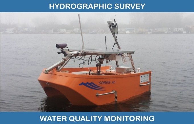
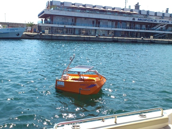
HYDROGRAPHIC SURVEY AND MONITORING OF COASTAL ZONE

1. Bathymetric survey
Includes:
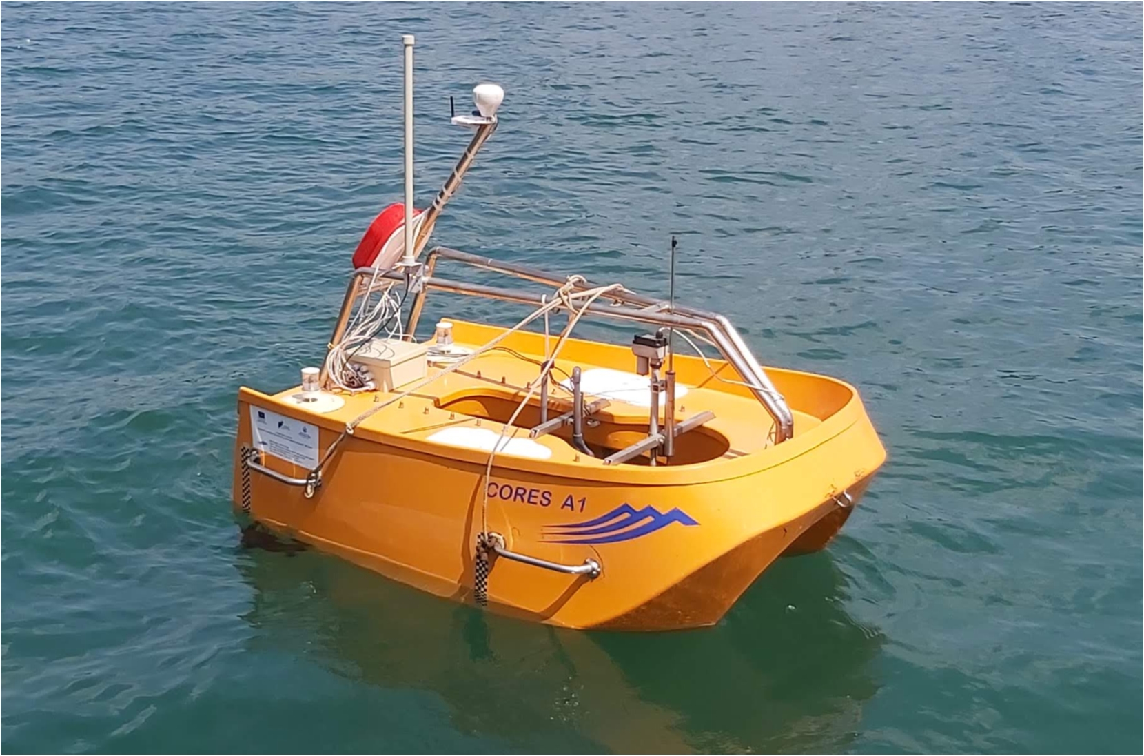
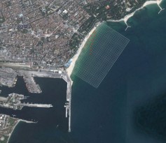
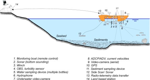
• Bottom (echo) sounding of a certain part of the coastal zone, as illustrated on Figure 1. Usually, the service includes also topography survey of the adjacent terrain/beach. As a result of the measurements, bathymetry and topography maps are produced, and/or a digital elevation model.
• Measurements are carried out by using (multibeam) echo sounding, and double GPS technology (technical information upon available GPS and sonar devices can be obtained upon request).
• Example resolution (distance between measurement points): 5 to 20 m
• Depth range : from 0.5 m до 20 m
• Accuracy:
depth: 0.03 m;
coordinates: 0.50m.
 |
 |
- • Survey results are presented in electronic format, using the following file types:
XYZ / ASCI files, including coordinates, and elevation (or reference water level and water depths)
XLS files, including coordinates
DWG geo-referenced spatial data (or SHP files)
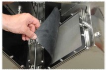
2. Water sampling for lab analysis
- • Water samples are collected using a submersible pump device with multiple bottles. To take a sample from a certain point the boat is positioned at the given coordinates, and the device is immersed to the prescribed depth, using the remote control from the land. Several samples can be collected along the depth profile, or in plan, during one run of the device.
• Water samples are collected and stored in a way for further laboratory analysis. The volume of the sample is 800 ml or more.
• Water samples are collected from multiple points with preliminary assigned spatial coordinates: latitude, altitude, water depth (elevation).
• It is the Customer who selects the parameters for laboratory analysis (e.g. pH, turbidity, dissolved oxygen, etc.), as well as the relevant way to transport/deliver samples to the selected laboratory.
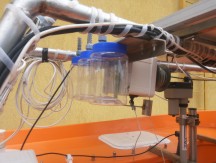
Figure 2: Water sampling device (3 bottles)
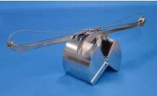
3. Sediment sampling
- • Sediment samples are collected using a sediment sampling device (grabber), as illustrated on Figure 3. The grabber is equipped with a 500 μm stainless sifter, and rubber lids, ISO certified.
• Water samples are collected and stored in a way for further laboratory analysis. The volume of the sample is 3 l.
• Water samples are collected from multiple points with preliminary assigned coordinates: latitude and altitude.
• It is the Customer who selects the parameters for laboratory analysis (e.g. grain-size analysis, density, organic contents, chemical contents, etc.), as well as the relevant way to transport/deliver samples to the selected laboratory.
 |
 |
| Figure 3: Sediment sampling device |
4. Current velocity measurements
- • Current velocities are measured using the following ways, according to the Customer’s requirement:
2-components measurements in a plane (Vx, Vy), using Acoustic Dopler Velocity - metter ADV (the velocity sensor is immersed at a certain level below the water surface)
Velocity profile , using Acoustic Dopler Current Profiler (ADCP), measurement along the water depth profile
• Measurements are carried out at multiple points with preliminary assigned coordinates: latitude and altitude (and water depths).
• Accuracy: 0.01 m/s
• Measurement results are presented in electronic format, XLS or ASCII files, including time of measurements, reference water level, coordinates (latitude, altitude, water depth), and velocity components (Vx, Vy).

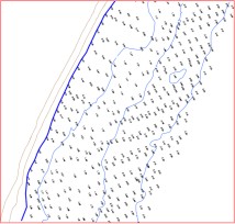
Figure 4: Example location of the measurement points for velocity, or turbidity, measurements
5. Turbidity (suspended solid concentration) measurements
- • Turbidity is measured using an Optical Back Scatter sensor, OBS, Campbell Scientific
• Measurements are carried out at multiple points with preliminary assigned coordinates: latitude and altitude (and water depths), as shown on Figures 1 and 4.
• In order to provide turbidity profile along the water depth, the boat is positioned in the given coordinates of the point, and the sensor is immersed from the surface to the bottom, using the automated winch operated by remote control from the land.
• Results are presented in NTU, or converted to mg/l using correlation formula;
• Range: up to 4,000 NTU, or up to 5,000 mg/l sediment concentrations
• Accuracy: up to 2 % (calibration needed by lab analysis of sediment concentration of samples from the water that will be monitored)
• Measurement results are presented in electronic format, XLS or ASCII files, including time of measurements, reference water level, coordinates (latitude, altitude, water depth), and turbidity values
6. Water temperature
7. Underwater observations
Includes:
• Observations of various object underwater, as follows:
- Video capture using high-resolution underwater camera (in clear water)
- Detecting debris items and other obstructions on the bottom, using Side Scan Sonar technique
- Bio-Environmental survey using Hydrophone technique
- Application of Hydrophone & Acoustic camera techniques to monitor infrastructure, boats, amd other objects (e.g. detect leaks, breaks)
• Observations are carried out using the above devices, and using also a submerged light. Devices are attached to a fixed telescopic road (up to 3 m), or to a winch (up to 20 m), remote operated.
|